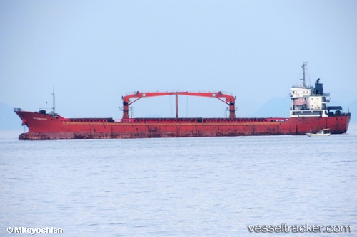
 CAPTAIN KANG
Current Status
Where is the vessel?
CAPTAIN KANG is currently in Near Bayuquan, based on AIS data received about 14h ago.
Latest AIS update:
Current position: 40.28763° N, 122.09249° E (Near Bayuquan)
Average speed (last 7 days): Loading…
Average speed (last 30 days): Loading…
Vessel profile: CAPTAIN KANG is a General Cargo with dimensions 130m x 18m.
This page combines live AIS, route history, probable destination signals, nearby traffic, and port activity for practical vessel monitoring.
The current position of vessel CAPTAIN KANG is 40.28763 lat / 122.09249 lng. Updated: 2026-05-20 00:18:02 UTCNearest reference points:
- Near Bayuquan
- 15 nm W of Bayuquan
- 17 nm SW of PANJIN
Currently sailing under the flag of Togo ![]()
CAPTAIN KANG built in 2005 year
Deadweight:
10279 tDetails:
Live Vessel CAPTAIN KANG Analytics (details, animations, etc.)
Recent AIS points (UTC):
2026-05-19 20:03:02 UTC · 40.28766, 122.09245 · SOG 0 kn · COG 63°2026-05-19 21:21:02 UTC · 40.28762, 122.09247 · SOG 0 kn · COG 63°
2026-05-19 22:24:05 UTC · 40.28764, 122.09246 · SOG 0 kn · COG 63°
2026-05-20 00:18:02 UTC · 40.28763, 122.09249 · SOG 0 kn · COG 63°