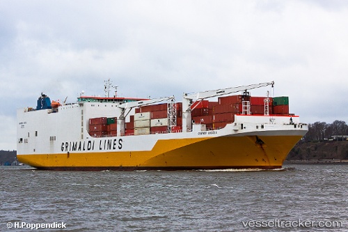
 Grande Angola
Current Status
Where is the vessel?
Grande Angola is currently in 30 nm S of San Pedro, based on AIS data received about 14h ago.
Latest AIS update:
Current position: 4.24197° N, 6.58830° W (30 nm S of San Pedro)
Average speed (last 7 days): Loading…
Average speed (last 30 days): Loading…
Vessel profile: Grande Angola is a Vehicles Carrier with dimensions 210m x 32m.
This page combines live AIS, route history, probable destination signals, nearby traffic, and port activity for practical vessel monitoring.
The current position of vessel Grande Angola is 4.24197 lat / -6.58830 lng. Updated: 2026-05-21 04:07:35 UTCNearest reference points:
- Near Espoir
- 98 nm SW of Harper
Currently sailing under the flag of Italy ![]()
Grande Angola built in 2008 year
Deadweight:
26881 tDetails:
Live Vessel Grande Angola Analytics (details, animations, etc.)
Recent AIS points (UTC):
2026-05-21 01:05:47 UTC · 4.02290, -7.38071 · SOG 16.2 kn · COG 92°2026-05-21 01:50:06 UTC · 4.06508, -7.18553 · SOG 16.3 kn · COG 75°
2026-05-21 03:21:35 UTC · 4.17996, -6.78601 · SOG 16.2 kn · COG 76°
2026-05-21 04:07:35 UTC · 4.24197, -6.58830 · SOG 16.3 kn · COG 77°