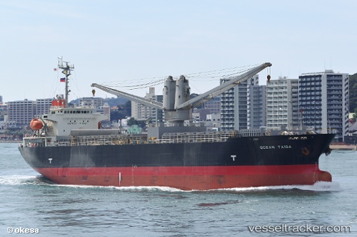
 Ocean Taiga
Current Status
Where is the vessel?
Ocean Taiga is currently in Near Taicang, based on AIS data received about 15h ago.
Latest AIS update:
Current position: 31.65952° N, 121.24160° E (Near Taicang)
Average speed (last 7 days): Loading…
Average speed (last 30 days): Loading…
Vessel profile: Ocean Taiga is a Multi Purpose Carrier with dimensions 120m x 21m.
This page combines live AIS, route history, probable destination signals, nearby traffic, and port activity for practical vessel monitoring.
The current position of vessel Ocean Taiga is 31.65952 lat / 121.24160 lng. Updated: 2026-05-20 17:06:59 UTCNearest reference points:
- Near Taicang
- Near Chongming
- Near Jiading
Currently sailing under the flag of Panama ![]()
Ocean Taiga built in 2006 year
Deadweight:
12909 tDetails:
Live Vessel Ocean Taiga Analytics (details, animations, etc.)
Recent AIS points (UTC):
2026-05-20 13:24:59 UTC · 31.65752, 121.24339 · SOG 0 kn · COG 307°2026-05-20 14:07:06 UTC · 31.65746, 121.24329 · SOG 0 kn · COG 311°
2026-05-20 15:48:56 UTC · 31.65744, 121.24320 · SOG 0 kn · COG 316°
2026-05-20 17:06:59 UTC · 31.65952, 121.24160 · SOG 0.4 kn · COG 169°