 HG MELBOURNE
Current Status
Where is the vessel?
HG MELBOURNE is currently in Near Callao, based on AIS data received about 14h ago.
Latest AIS update:
Current position: 12.01099° S, 77.23354° W (Near Callao)
Average speed (last 7 days): Loading…
Average speed (last 30 days): Loading…
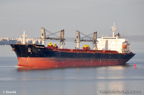
Vessel profile: HG MELBOURNE is a Bulk Carrier with dimensions 190m x 32m.
This page combines live AIS, route history, probable destination signals, nearby traffic, and port activity for practical vessel monitoring.
The current position of vessel HG MELBOURNE is -12.01099 lat / -77.23354 lng. Updated: 2026-05-20 16:40:57 UTCNearest reference points:
- Near Callao
- 43 nm SW of Barranca
- 125 nm SW of Supe Bay
Currently sailing under the flag of Liberia ![]()
HG MELBOURNE built in 2007 year
Deadweight:
53596 tDetails:
Live Vessel HG MELBOURNE Analytics (details, animations, etc.)
Recent AIS points (UTC):
2026-05-20 13:28:57 UTC · -12.01213, -77.23429 · SOG 0.3 kn · COG 105°2026-05-20 14:01:59 UTC · -12.01195, -77.23448 · SOG 0.1 kn · COG 110°
2026-05-20 16:22:52 UTC · -12.01109, -77.23378 · SOG 0.1 kn · COG 146°
2026-05-20 16:40:57 UTC · -12.01099, -77.23354 · SOG 0.1 kn · COG 155°