 vesseltracker.com
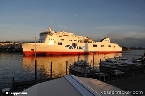
 CONNEMARA
Current Status
Where is the vessel?
CONNEMARA is currently in Near WAIKAWA, based on AIS data received about 16h ago.
Latest AIS update:
Current position: 41.27822° S, 174.01180° E (Near WAIKAWA)
Average speed (last 7 days): Loading…
Average speed (last 30 days): Loading…
Vessel profile: CONNEMARA is a Ro-Ro/Passenger Ship with dimensions m x m.
This page combines live AIS, route history, probable destination signals, nearby traffic, and port activity for practical vessel monitoring.
The current position of vessel CONNEMARA is -41.27822 lat / 174.01180 lng. Updated: 2026-05-18 11:28:23 UTCNearest reference points:
- Near WAIKAWA
- Near Renwick
- Near Nelson
Currently sailing under the flag of Bahamas ![]()
Details:
Live Vessel CONNEMARA Analytics (details, animations, etc.)
Recent AIS points (UTC):
2026-05-18 08:11:42 UTC · -41.28260, 174.78401 · SOG 3.7 kn · COG 170°2026-05-18 10:14:31 UTC · -41.23307, 174.35353 · SOG 16 kn · COG 302°
2026-05-18 10:16:00 UTC · -41.22918, 174.34631 · SOG 16 kn · COG 302°
2026-05-18 11:28:23 UTC · -41.27822, 174.01180 · SOG 6.7 kn · COG 206°