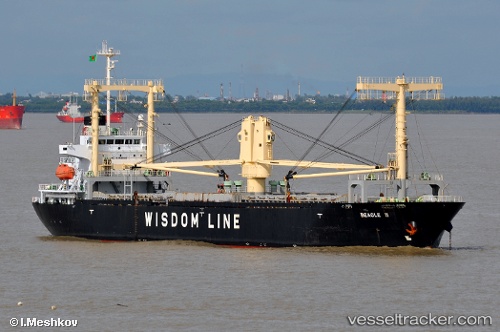
Beagle Ii
Current StatusWhere is the vessel?
Beagle Ii is currently in 119 nm SW of Gan, based on AIS data received about 14h ago.
Latest AIS update:
Current position: 2.52571° S, 72.36539° E (119 nm SW of Gan)
Average speed (last 7 days): Loading…
Average speed (last 30 days): Loading…
Vessel profile: Beagle Ii is a Multi Purpose Carrier with dimensions 23m x 130m.
This page combines live AIS, route history, probable destination signals, nearby traffic, and port activity for practical vessel monitoring.
The current position of vessel Beagle Ii is -2.52571 lat / 72.36539 lng. Updated: 2026-05-20 13:22:20 UTCNearest reference points:
- 222 nm SW of Gan
- 195 nm SE of Gan
Details:
Live Vessel Beagle Ii Analytics (details, animations, etc.)
Recent AIS points (UTC):
2026-05-20 10:19:16 UTC · -2.72811, 71.83679 · SOG 11 kn · COG 67°2026-05-20 11:08:26 UTC · -2.67225, 71.97800 · SOG 11 kn · COG 67°
2026-05-20 11:19:27 UTC · -2.66065, 72.00992 · SOG 11 kn · COG 66°
2026-05-20 13:22:20 UTC · -2.52571, 72.36539 · SOG 11.3 kn · COG 64°