 KNIDOS M
Current Status
Where is the vessel?
KNIDOS M is currently in 81 nm SW of Cpc Terminal, based on AIS data received about 21h ago.
Latest AIS update:
Current position: 43.49667° N, 36.70667° E (81 nm SW of Cpc Terminal)
Average speed (last 7 days): Loading…
Average speed (last 30 days): Loading…
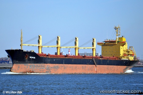
Vessel profile: KNIDOS M is a Bulk Carrier with dimensions m x m.
This page combines live AIS, route history, probable destination signals, nearby traffic, and port activity for practical vessel monitoring.
The current position of vessel KNIDOS M is 43.49667 lat / 36.70667 lng. Updated: 2026-05-19 05:05:21 UTCNearest reference points:
- 26 nm SW of Cpc Terminal
- 54 nm NE of Sinop
- 79 nm SE of Yalta
Currently sailing under the flag of Panama ![]()
Details:
Live Vessel KNIDOS M Analytics (details, animations, etc.)
Recent AIS points (UTC):
2026-05-19 05:05:21 UTC · 43.49667, 36.70667 · SOG 1 kn · COG -1°2026-05-19 05:05:21 UTC · 43.49667, 36.70667 · SOG 1 kn · COG -1°
2026-05-19 05:05:21 UTC · 43.49667, 36.70667 · SOG 1 kn · COG -1°
2026-05-19 05:05:21 UTC · 43.49667, 36.70667 · SOG 1 kn · COG -1°