 vesseltracker.com
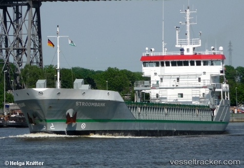
 Stroombank
Current Status
Where is the vessel?
Stroombank is currently in 15 nm NW of Oostende, based on AIS data received less than 1h ago.
Latest AIS update:
Current position: 51.40444° N, 2.61851° E (15 nm NW of Oostende)
Average speed (last 7 days): Loading…
Average speed (last 30 days): Loading…
Vessel profile: Stroombank is a General Cargo Ship with dimensions 90m x 15m.
This page combines live AIS, route history, probable destination signals, nearby traffic, and port activity for practical vessel monitoring.
The current position of vessel Stroombank is 51.40444 lat / 2.61851 lng. Updated: 2026-04-27 19:28:14 UTCNearest reference points:
- 13 nm NW of Middelkerke
- Near Lombardsijde
- Near Oostende
Currently sailing under the flag of Netherlands ![]()
Stroombank built in 2009 year
Deadweight:
4550 tDetails:
Live Vessel Stroombank Analytics (details, animations, etc.)
Recent AIS points (UTC):
2026-04-27 16:13:15 UTC · 51.40479, 2.61867 · SOG 0 kn · COG 40°2026-04-27 16:46:18 UTC · 51.40484, 2.61842 · SOG 0 kn · COG 43°
2026-04-27 17:38:31 UTC · 51.40467, 2.61847 · SOG 0 kn · COG 45°
2026-04-27 19:28:14 UTC · 51.40444, 2.61851 · SOG 0.1 kn · COG 54°