 vesseltracker.com
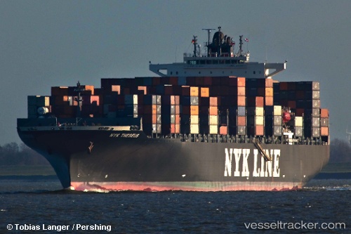
 ONE THESEUS
Current Status
Where is the vessel?
ONE THESEUS is currently in 73 nm E of Konwelana, based on AIS data received about 14h ago.
Latest AIS update:
Current position: 5.88755° N, 82.45109° E (73 nm E of Konwelana)
Average speed (last 7 days): Loading…
Average speed (last 30 days): Loading…
Vessel profile: ONE THESEUS is a Container Ship with dimensions 40m x 304m.
This page combines live AIS, route history, probable destination signals, nearby traffic, and port activity for practical vessel monitoring.
The current position of vessel ONE THESEUS is 5.88755 lat / 82.45109 lng. Updated: 2026-05-17 22:21:55 UTCNearest reference points:
- 75 nm E of Konwelana
- 79 nm E of Konwelana
- 53 nm SE of Konwelana
Currently sailing under the flag of Japan ![]()
ONE THESEUS built in 2008 year
Deadweight:
80220 tDetails:
Live Vessel ONE THESEUS Analytics (details, animations, etc.)
Recent AIS points (UTC):
2026-05-17 17:45:16 UTC · 5.93985, 83.71173 · SOG 16.3 kn · COG 265°2026-05-17 17:45:16 UTC · 5.93985, 83.71173 · SOG 16.3 kn · COG 265°
2026-05-17 20:58:09 UTC · 5.91294, 82.83299 · SOG 15.9 kn · COG 266°
2026-05-17 22:21:55 UTC · 5.88755, 82.45109 · SOG 16.4 kn · COG 268°