 Chiquita Progress
Current Status
Where is the vessel?
Chiquita Progress is currently in Near Puerto San José, based on AIS data received about 16h ago.
Latest AIS update:
Current position: 13.92407° N, 90.78610° W (Near Puerto San José)
Average speed (last 7 days): Loading…
Average speed (last 30 days): Loading…
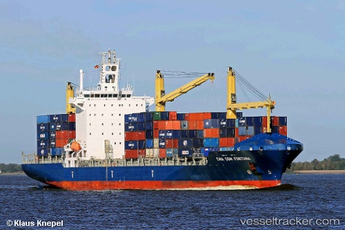
Vessel profile: Chiquita Progress is a Container Ship with dimensions 202m x 204m.
This page combines live AIS, route history, probable destination signals, nearby traffic, and port activity for practical vessel monitoring.
The current position of vessel Chiquita Progress is 13.92407 lat / -90.78610 lng. Updated: 2026-05-20 16:16:30 UTCNearest reference points:
- Near San Jose
Currently sailing under the flag of Liberia ![]()
Chiquita Progress built in 2007 year
Deadweight:
30562 tDetails:
Live Vessel Chiquita Progress Analytics (details, animations, etc.)
Recent AIS points (UTC):
2026-05-20 13:42:23 UTC · 13.92405, -90.78606 · SOG 0 kn · COG 340°2026-05-20 13:57:30 UTC · 13.92404, -90.78608 · SOG 0 kn · COG 340°
2026-05-20 16:07:25 UTC · 13.92407, -90.78609 · SOG 0 kn · COG 340°
2026-05-20 16:16:30 UTC · 13.92407, -90.78610 · SOG 0 kn · COG 340°