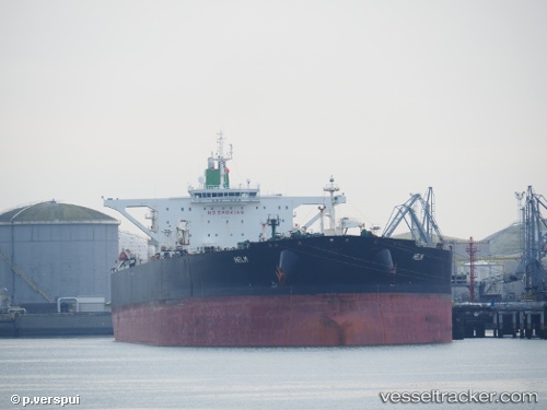
 Helm
Helm
Current Status
Where is the vessel?
Helm is currently in 33 nm W of Kuala Selangor, based on AIS data received about 20d ago.
Latest AIS update:
Current position: 3.36217° N, 100.50166° E (33 nm W of Kuala Selangor)
Average speed (last 7 days): Loading…
Average speed (last 30 days): Loading…
Vessel profile: Helm is a Crude Oil Tanker with dimensions 333m x 333m.
This page combines live AIS, route history, probable destination signals, nearby traffic, and port activity for practical vessel monitoring.
The current position of vessel Helm is 3.36217 lat / 100.50166 lng. Updated: 2026-04-30 19:28:22 UTCNearest reference points:
- Near Westport/Port Klang
- 11 nm W of Pangkur
- Near PANGKOR
Currently sailing under the flag of Iran ![]()
Helm built in 2008 year
Deadweight:
317356 tDetails:
Live Vessel Helm Analytics (details, animations, etc.)
Recent AIS points (UTC):
2026-04-30 19:28:22 UTC · 3.36217, 100.50166 · SOG 9.9 kn · COG 317°