 Isis
Isis
Current Status
Where is the vessel?
Isis is currently in Near Porlock, based on AIS data received about 14h ago.
Latest AIS update:
Current position: 51.21728° N, 3.39120° W (Near Porlock)
Average speed (last 7 days): Loading…
Average speed (last 30 days): Loading…
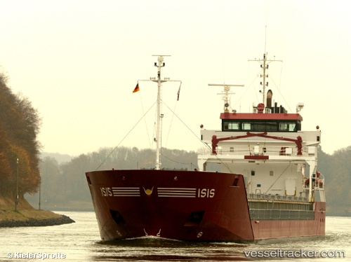
Vessel profile: Isis is a Multi Purpose Carrier with dimensions 111m x 14m.
This page combines live AIS, route history, probable destination signals, nearby traffic, and port activity for practical vessel monitoring.
The current position of vessel Isis is 51.21728 lat / -3.39120 lng. Updated: 2026-05-20 00:09:20 UTCNearest reference points:
- Near Leckwith
- Near Penarth
- Near Bird Port
Currently sailing under the flag of Netherlands ![]()
Isis built in 2007 year
Deadweight:
6000 tDetails:
Live Vessel Isis Analytics (details, animations, etc.)
Recent AIS points (UTC):
2026-05-19 19:48:48 UTC · 51.35116, -3.24988 · SOG 9.2 kn · COG 233°2026-05-19 22:13:18 UTC · 51.21782, -3.39051 · SOG 0.1 kn · COG 141°
2026-05-19 23:06:07 UTC · 51.21752, -3.39114 · SOG 0.1 kn · COG 139°
2026-05-20 00:09:20 UTC · 51.21728, -3.39120 · SOG 0.1 kn · COG 135°