Ef Emma
Current StatusWhere is the vessel?
Ef Emma is currently in 22 nm E of Beira, based on AIS data received about 15h ago.
Latest AIS update:
Current position: 19.95096° S, 35.19922° E (22 nm E of Beira)
Average speed (last 7 days): Loading…
Average speed (last 30 days): Loading…
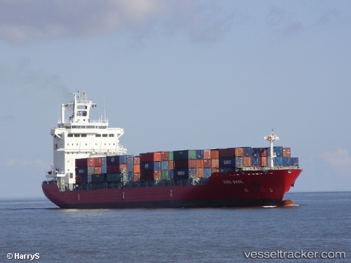
Vessel profile: Ef Emma is a Container Ship with dimensions 25m x 182m.
This page combines live AIS, route history, probable destination signals, nearby traffic, and port activity for practical vessel monitoring.
The current position of vessel Ef Emma is -19.95096 lat / 35.19922 lng. Updated: 2026-05-20 13:49:24 UTCNearest reference points:
- 21 nm SE of Beira
- 24 nm SE of Beira
- 14 nm E of Beira
Details:
Live Vessel Ef Emma Analytics (details, animations, etc.)
Recent AIS points (UTC):
2026-05-20 10:16:24 UTC · -19.94988, 35.20247 · SOG 0.2 kn · COG 189°2026-05-20 11:37:23 UTC · -19.94976, 35.20102 · SOG 0 kn · COG 166°
2026-05-20 13:01:23 UTC · -19.95057, 35.19962 · SOG 0.4 kn · COG 151°
2026-05-20 13:49:24 UTC · -19.95096, 35.19922 · SOG 0.3 kn · COG 143°