 THOR B
Current Status
Where is the vessel?
THOR B is currently in Near Horta, based on AIS data received about 15h ago.
Latest AIS update:
Current position: 38.53060° N, 28.62182° W (Near Horta)
Average speed (last 7 days): Loading…
Average speed (last 30 days): Loading…
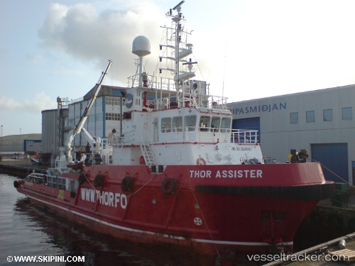
Vessel profile: THOR B is a Offshore Tug/Supply Ship with dimensions 45m x 12m.
This page combines live AIS, route history, probable destination signals, nearby traffic, and port activity for practical vessel monitoring.
The current position of vessel THOR B is 38.53060 lat / -28.62182 lng. Updated: 2026-05-21 04:22:17 UTCNearest reference points:
- Near Praia Da Vitoria
Currently sailing under the flag of Portugal ![]()
THOR B built in 2006 year
Deadweight:
589 tDetails:
Live Vessel THOR B Analytics (details, animations, etc.)
Recent AIS points (UTC):
2026-05-21 01:29:36 UTC · 38.53062, -28.62179 · SOG 0 kn · COG 195°2026-05-21 02:28:18 UTC · 38.53062, -28.62185 · SOG 0 kn · COG 196°
2026-05-21 03:32:51 UTC · 38.53061, -28.62177 · SOG 0 kn · COG 195°
2026-05-21 04:22:17 UTC · 38.53060, -28.62182 · SOG 0 kn · COG 195°