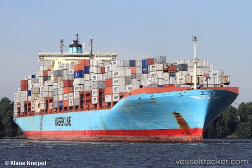
 GERDA MAERSK
Current Status
Where is the vessel?
GERDA MAERSK is currently in 54 nm SE of JINGTANG, based on AIS data received about 14h ago.
Latest AIS update:
Current position: 38.64667° N, 119.92333° E (54 nm SE of JINGTANG)
Average speed (last 7 days): Loading…
Average speed (last 30 days): Loading…
Vessel profile: GERDA MAERSK is a Container Ship with dimensions m x m.
This page combines live AIS, route history, probable destination signals, nearby traffic, and port activity for practical vessel monitoring.
The current position of vessel GERDA MAERSK is 38.64667 lat / 119.92333 lng. Updated: 2026-05-20 12:59:56 UTCNearest reference points:
- 43 nm NE of DONGYING
- 39 nm E of JINGTANG
- 38 nm NW of Changdao
Currently sailing under the flag of Hong Kong ![]()
Details:
Live Vessel GERDA MAERSK Analytics (details, animations, etc.)
Recent AIS points (UTC):
2026-05-20 09:46:49 UTC · 38.69960, 119.35116 · SOG 8.3 kn · COG -1°2026-05-20 10:40:07 UTC · 38.67803, 119.50570 · SOG 8.2 kn · COG 93°
2026-05-20 12:02:06 UTC · 38.66822, 119.74627 · SOG 8 kn · COG 98°
2026-05-20 12:59:56 UTC · 38.64667, 119.92333 · SOG 9 kn · COG -1°