 vesseltracker.com
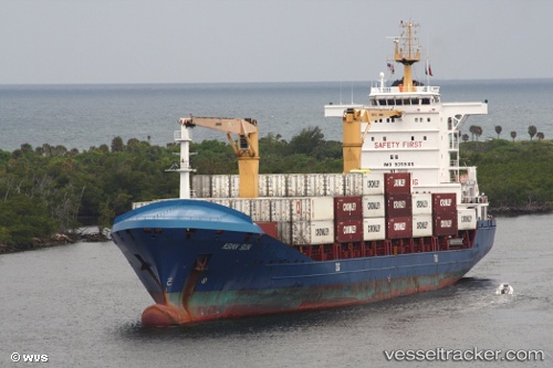
 AFRICA SUN
Current Status
Where is the vessel?
AFRICA SUN is currently in 50 nm NE of Tusdeer Free Zone, based on AIS data received less than 1h ago.
Latest AIS update:
Current position: 21.87281° N, 39.94553° E (50 nm NE of Tusdeer Free Zone)
Average speed (last 7 days): Loading…
Average speed (last 30 days): Loading…
Vessel profile: AFRICA SUN is a Container Ship with dimensions 24m x 148m.
This page combines live AIS, route history, probable destination signals, nearby traffic, and port activity for practical vessel monitoring.
The current position of vessel AFRICA SUN is 21.87281 lat / 39.94553 lng. Updated: 2026-05-13 21:15:06 UTCNearest reference points:
- 14 nm N of Tusdeer Free Zone
- 22 nm N of Tusdeer Free Zone
- Near Jeddah
Currently sailing under the flag of Djibouti ![]()
AFRICA SUN built in 2006 year
Deadweight:
13719 tDetails:
Live Vessel AFRICA SUN Analytics (details, animations, etc.)
Recent AIS points (UTC):
2026-05-13 18:17:28 UTC · 20.51053, 38.49389 · SOG 22.3 kn · COG 271°2026-05-13 18:54:07 UTC · 20.76562, 38.75977 · SOG 29.5 kn · COG 284°
2026-05-13 20:04:22 UTC · 21.32956, 39.36283 · SOG 8.3 kn · COG 277°
2026-05-13 21:15:06 UTC · 21.87281, 39.94553 · SOG 27.6 kn · COG 285°