Ami
Current StatusWhere is the vessel?
Ami is currently in 86 nm N of San Juan, based on AIS data received about 14h ago.
Latest AIS update:
Current position: 19.89387° N, 66.23688° W (86 nm N of San Juan)
Average speed (last 7 days): Loading…
Average speed (last 30 days): Loading…
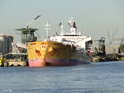
Vessel profile: Ami is a Chemical Oil Products Tanker with dimensions 24m x 143m.
This page combines live AIS, route history, probable destination signals, nearby traffic, and port activity for practical vessel monitoring.
The current position of vessel Ami is 19.89387 lat / -66.23688 lng. Updated: 2026-05-21 04:05:13 UTCNearest reference points:
- Near San Juan
- 24 nm N of CULEBRA
- Near Roosevelt Roads
Details:
Live Vessel Ami Analytics (details, animations, etc.)
Recent AIS points (UTC):
2026-05-20 23:30:13 UTC · 20.34307, -65.42163 · SOG 11.8 kn · COG 245°2026-05-21 01:58:24 UTC · 20.09753, -65.86108 · SOG 11.7 kn · COG 245°
2026-05-21 02:01:45 UTC · 20.09275, -65.87152 · SOG 11.7 kn · COG 240°
2026-05-21 04:05:13 UTC · 19.89387, -66.23688 · SOG 11.5 kn · COG 242°