 vesseltracker.com
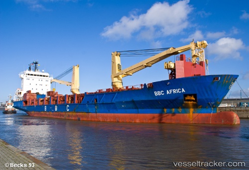
 Bbc Africa
Current Status
Where is the vessel?
Bbc Africa is currently in 21 nm W of Buenaventura, based on AIS data received about 1h ago.
Latest AIS update:
Current position: 3.83157° N, 77.42526° W (21 nm W of Buenaventura)
Average speed (last 7 days): Loading…
Average speed (last 30 days): Loading…
Vessel profile: Bbc Africa is a Multi Purpose Carrier with dimensions 120m x 20m.
This page combines live AIS, route history, probable destination signals, nearby traffic, and port activity for practical vessel monitoring.
The current position of vessel Bbc Africa is 3.83157 lat / -77.42526 lng. Updated: 2026-05-15 05:19:16 UTCNearest reference points:
- 33 nm W of Buenaventura
- Near Buenaventura
Currently sailing under the flag of Antigua Barbuda ![]()
Bbc Africa built in 2005 year
Deadweight:
7530 tDetails:
Live Vessel Bbc Africa Analytics (details, animations, etc.)
Recent AIS points (UTC):
2026-05-14 23:33:35 UTC · 3.89305, -77.07999 · SOG 0 kn · COG 265°2026-05-15 03:56:47 UTC · 3.83158, -77.15230 · SOG 11.7 kn · COG 246°
2026-05-15 04:12:24 UTC · 3.80748, -77.19824 · SOG 12.1 kn · COG 239°
2026-05-15 05:19:16 UTC · 3.83157, -77.42526 · SOG 14 kn · COG 288°