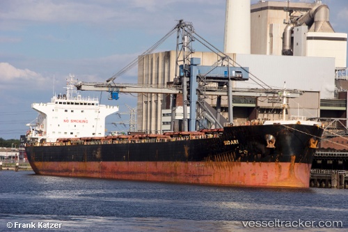
 Sidari
Current Status
Where is the vessel?
Sidari is currently in 33 nm E of Dokdo, based on AIS data received about 14h ago.
Latest AIS update:
Current position: 37.04488° N, 132.50809° E (33 nm E of Dokdo)
Average speed (last 7 days): Loading…
Average speed (last 30 days): Loading…
Vessel profile: Sidari is a Bulk Carrier with dimensions 225m x 225m.
This page combines live AIS, route history, probable destination signals, nearby traffic, and port activity for practical vessel monitoring.
The current position of vessel Sidari is 37.04488 lat / 132.50809 lng. Updated: 2026-05-20 11:22:51 UTCNearest reference points:
- 37 nm NW of NAKANOSHIMA
- 80 nm NE of Dokdo
- 82 nm NE of Dokdo
Currently sailing under the flag of Malta ![]()
Sidari built in 2007 year
Deadweight:
75204 tDetails:
Live Vessel Sidari Analytics (details, animations, etc.)
Recent AIS points (UTC):
2026-05-20 07:51:04 UTC · 36.62089, 131.77567 · SOG 12.5 kn · COG 58°2026-05-20 09:58:52 UTC · 36.87500, 132.21333 · SOG 12 kn · COG -1°
2026-05-20 10:08:00 UTC · 36.89167, 132.24500 · SOG 12 kn · COG -1°
2026-05-20 11:22:51 UTC · 37.04488, 132.50809 · SOG 11.8 kn · COG -1°