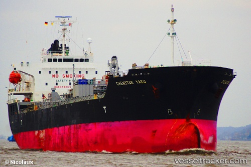
Bay Yasu
Current StatusWhere is the vessel?
Bay Yasu is currently in 83 nm SE of Nanao Pt, based on AIS data received about 14h ago.
Latest AIS update:
Current position: 22.27268° N, 118.50007° E (83 nm SE of Nanao Pt)
Average speed (last 7 days): Loading…
Average speed (last 30 days): Loading…
Vessel profile: Bay Yasu is a Chemical Oil Products Tanker with dimensions 24m x 147m.
This page combines live AIS, route history, probable destination signals, nearby traffic, and port activity for practical vessel monitoring.
The current position of vessel Bay Yasu is 22.27268 lat / 118.50007 lng. Updated: 2026-05-20 19:15:41 UTCNearest reference points:
- 96 nm SW of Kaohsiung
- 47 nm E of Nanao Pt
- Near Nanao Pt
Details:
Live Vessel Bay Yasu Analytics (details, animations, etc.)
Recent AIS points (UTC):
2026-05-20 15:56:10 UTC · 22.34336, 119.13630 · SOG 11.1 kn · COG 264°2026-05-20 16:35:14 UTC · 22.32982, 119.00749 · SOG 10.9 kn · COG 266°
2026-05-20 17:37:33 UTC · 22.31025, 118.80550 · SOG 10.7 kn · COG 269°
2026-05-20 19:15:41 UTC · 22.27268, 118.50007 · SOG 10.3 kn · COG 260°