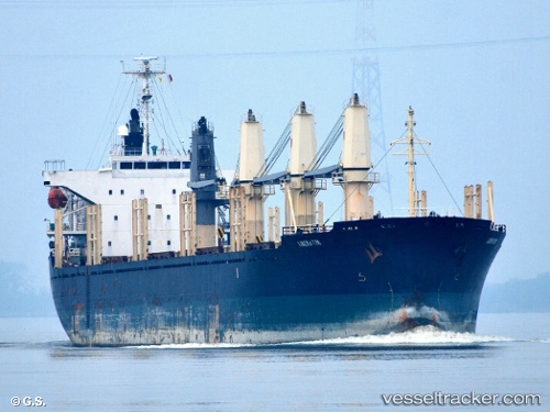
Liberator
Current StatusWhere is the vessel?
Liberator is currently in 15 nm S of Kandla-SEZ/Gandhidham, based on AIS data received about 8d ago.
Latest AIS update:
Current position: 22.79982° N, 70.14085° E (15 nm S of Kandla-SEZ/Gandhidham)
Average speed (last 7 days): Loading…
Average speed (last 30 days): Loading…
Vessel profile: Liberator is a Bulk Carrier with dimensions 27m x 169m.
This page combines live AIS, route history, probable destination signals, nearby traffic, and port activity for practical vessel monitoring.
The current position of vessel Liberator is 22.79982 lat / 70.14085 lng. Updated: 2026-05-12 12:04:57 UTCNearest reference points:
- 15 nm N of Rozi
- 12 nm N of Rozi
- Near Kandla
Details:
Live Vessel Liberator Analytics (details, animations, etc.)
Recent AIS points (UTC):
2026-05-12 12:04:57 UTC · 22.79982, 70.14085 · SOG 0.1 kn · COG 253°2026-05-12 12:04:57 UTC · 22.79982, 70.14085 · SOG 0.1 kn · COG 253°
2026-05-12 12:04:57 UTC · 22.79982, 70.14085 · SOG 0.1 kn · COG 253°
2026-05-12 12:04:57 UTC · 22.79982, 70.14085 · SOG 0.1 kn · COG 253°