 QUEEN ANTONIA
Current Status
Where is the vessel?
QUEEN ANTONIA is currently in Near Neeltje Jans, based on AIS data received about 14h ago.
Latest AIS update:
Current position: 53.58992° N, 3.94303° E (Near Neeltje Jans)
Average speed (last 7 days): Loading…
Average speed (last 30 days): Loading…
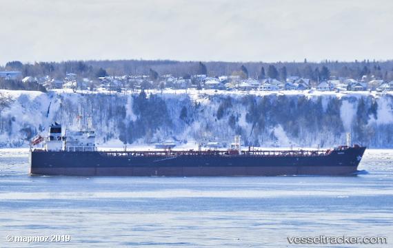
Vessel profile: QUEEN ANTONIA is a Oil/Chemical Tanker with dimensions m x m.
This page combines live AIS, route history, probable destination signals, nearby traffic, and port activity for practical vessel monitoring.
The current position of vessel QUEEN ANTONIA is 53.58992 lat / 3.94303 lng. Updated: 2026-05-19 19:25:35 UTCNearest reference points:
- Near Neeltje Jans
- 19 nm NW of Neeltje Jans
- Near Molengat
Currently sailing under the flag of Bahamas ![]()
Details:
Live Vessel QUEEN ANTONIA Analytics (details, animations, etc.)
Recent AIS points (UTC):
2026-05-19 16:20:33 UTC · 52.91077, 3.34959 · SOG 15.5 kn · COG 27°2026-05-19 17:22:32 UTC · 53.16085, 3.50367 · SOG 15.4 kn · COG 19°
2026-05-19 19:25:35 UTC · 53.58992, 3.94303 · SOG 14.6 kn · COG 54°
2026-05-19 19:25:35 UTC · 53.58992, 3.94303 · SOG 14.6 kn · COG 54°