 KARADENIZ POWERSHIP TURKER BEY
Current Status
Where is the vessel?
KARADENIZ POWERSHIP TURKER BEY is currently in Near NITEROI, based on AIS data received about 15h ago.
Latest AIS update:
Current position: 22.85113° S, 43.13591° W (Near NITEROI)
Average speed (last 7 days): Loading…
Average speed (last 30 days): Loading…
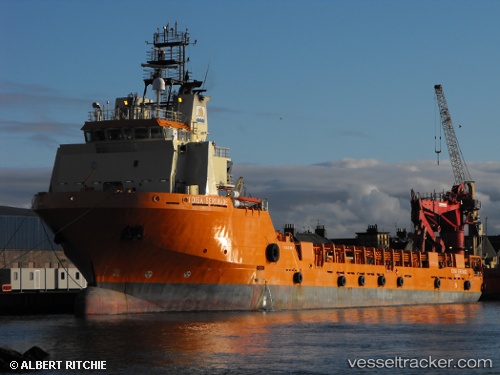
Vessel profile: KARADENIZ POWERSHIP TURKER BEY is a Offshore Supply Ship with dimensions 87m x 19m.
This page combines live AIS, route history, probable destination signals, nearby traffic, and port activity for practical vessel monitoring.
The current position of vessel KARADENIZ POWERSHIP TURKER BEY is -22.85113 lat / -43.13591 lng. Updated: 2026-05-20 23:55:11 UTCNearest reference points:
- Near NITEROI
- Near Rio De Janeiro
- Near Santos Dumont Apt/Rio de Janeiro
Currently sailing under the flag of Liberia ![]()
KARADENIZ POWERSHIP TURKER BEY built in 2008 year
Deadweight:
4900 tDetails:
Live Vessel KARADENIZ POWERSHIP TURKER BEY Analytics (details, animations, etc.)
Recent AIS points (UTC):
2026-05-20 19:28:11 UTC · -22.85099, -43.13600 · SOG 0 kn · COG 254°2026-05-20 21:49:26 UTC · -22.85099, -43.13590 · SOG 0 kn · COG 302°
2026-05-20 22:19:24 UTC · -22.85102, -43.13590 · SOG 0 kn · COG 308°
2026-05-20 23:55:11 UTC · -22.85113, -43.13591 · SOG 0.1 kn · COG 275°