 A BOTE
Current Status
Where is the vessel?
A BOTE is currently in Near El Saler, based on AIS data received about 14h ago.
Latest AIS update:
Current position: 39.39508° N, 0.27917° W (Near El Saler)
Average speed (last 7 days): Loading…
Average speed (last 30 days): Loading…
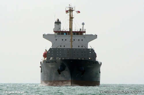
Vessel profile: A BOTE is a Container Ship with dimensions 145m x 22m.
This page combines live AIS, route history, probable destination signals, nearby traffic, and port activity for practical vessel monitoring.
The current position of vessel A BOTE is 39.39508 lat / -0.27917 lng. Updated: 2026-05-22 10:06:55 UTCNearest reference points:
- Near Valencia
- Near Puebla de Farnals
- Near GANDIA
Currently sailing under the flag of Panama ![]()
A BOTE built in 2007 year
Deadweight:
12582 tDetails:
Live Vessel A BOTE Analytics (details, animations, etc.)
Recent AIS points (UTC):
2026-05-22 07:27:55 UTC · 39.39375, -0.27652 · SOG 0 kn · COG 286°2026-05-22 08:09:52 UTC · 39.39330, -0.27692 · SOG 0 kn · COG 315°
2026-05-22 09:48:53 UTC · 39.39501, -0.27923 · SOG 0.1 kn · COG 129°
2026-05-22 10:06:55 UTC · 39.39508, -0.27917 · SOG 0 kn · COG 132°