 vesseltracker.com
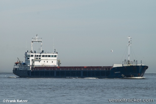
 TAGUS RIVER
Current Status
Where is the vessel?
TAGUS RIVER is currently in Near ORTONA, based on AIS data received about 2h ago.
Latest AIS update:
Current position: 42.35140° N, 14.41083° E (Near ORTONA)
Average speed (last 7 days): Loading…
Average speed (last 30 days): Loading…
Vessel profile: TAGUS RIVER is a General Cargo Ship with dimensions m x 121m.
This page combines live AIS, route history, probable destination signals, nearby traffic, and port activity for practical vessel monitoring.
The current position of vessel TAGUS RIVER is 42.35140 lat / 14.41083 lng. Updated: 2026-04-21 03:52:54 UTCNearest reference points:
- Near Pescara
- Near TERMOLI
- 19 nm E of Pedaso
Currently sailing under the flag of Panama ![]()
TAGUS RIVER built in 2007 year
Deadweight:
6354 tDetails:
Live Vessel TAGUS RIVER Analytics (details, animations, etc.)
Recent AIS points (UTC):
2026-04-21 01:38:18 UTC · 42.35139, 14.41082 · SOG 0 kn · COG 172°2026-04-21 01:38:18 UTC · 42.35139, 14.41082 · SOG 0 kn · COG 172°
2026-04-21 02:53:32 UTC · 42.35139, 14.41081 · SOG 0 kn · COG 176°
2026-04-21 03:52:54 UTC · 42.35140, 14.41083 · SOG 0 kn · COG 172°