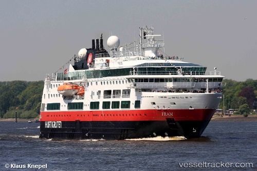
 Fram
Fram
Current Status
Where is the vessel?
Fram is currently in 78 nm SE of Bjornoya, based on AIS data received about 14h ago.
Latest AIS update:
Current position: 73.33989° N, 21.34560° E (78 nm SE of Bjornoya)
Average speed (last 7 days): Loading…
Average speed (last 30 days): Loading…
Vessel profile: Fram is a Cruise Ship with dimensions 114m x 20m.
This page combines live AIS, route history, probable destination signals, nearby traffic, and port activity for practical vessel monitoring.
The current position of vessel Fram is 73.33989 lat / 21.34560 lng. Updated: 2026-05-20 07:36:38 UTCNearest reference points:
- 40 nm SW of Snohvit
Currently sailing under the flag of Norway ![]()
Fram built in 2007 year
Deadweight:
984 tDetails:
Live Vessel Fram Analytics (details, animations, etc.)
Recent AIS points (UTC):
2026-05-20 04:24:41 UTC · 72.82167, 22.55333 · SOG 12 kn · COG -1°2026-05-20 04:24:41 UTC · 72.82167, 22.55333 · SOG 12 kn · COG -1°
2026-05-20 05:41:38 UTC · 73.03707, 22.06865 · SOG 12 kn · COG 325°
2026-05-20 07:36:38 UTC · 73.33989, 21.34560 · SOG 11.7 kn · COG 328°