 vesseltracker.com
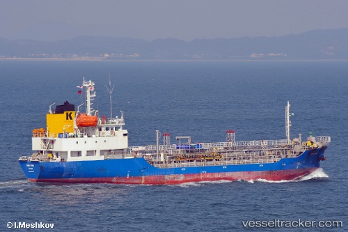
 GLORY HANA
Current Status
Where is the vessel?
GLORY HANA is currently in 16 nm S of Seongsan-po, based on AIS data received about 14h ago.
Latest AIS update:
Current position: 33.18400° N, 126.88593° E (16 nm S of Seongsan-po)
Average speed (last 7 days): Loading…
Average speed (last 30 days): Loading…
Vessel profile: GLORY HANA is a Oil/Chemical Tanker with dimensions m x m.
This page combines live AIS, route history, probable destination signals, nearby traffic, and port activity for practical vessel monitoring.
The current position of vessel GLORY HANA is 33.18400 lat / 126.88593 lng. Updated: 2026-05-17 20:16:38 UTCNearest reference points:
- 10 nm E of Seongsan-po
- 22 nm S of Seogwipo
- Near Bukjeju-gun
Currently sailing under the flag of South Korea ![]()
Details:
Live Vessel GLORY HANA Analytics (details, animations, etc.)
Recent AIS points (UTC):
2026-05-17 16:11:40 UTC · 33.60582, 127.63284 · SOG 11 kn · COG 237°2026-05-17 17:30:30 UTC · 33.46500, 127.39500 · SOG 11 kn · COG -1°
2026-05-17 19:59:28 UTC · 33.21418, 126.93806 · SOG 10.9 kn · COG 237°
2026-05-17 20:16:38 UTC · 33.18400, 126.88593 · SOG 11 kn · COG 237°