 NAVIGATOR
Current Status
Where is the vessel?
NAVIGATOR is currently in Near Fiumicino, based on AIS data received about 14h ago.
Latest AIS update:
Current position: 41.70536° N, 12.17914° E (Near Fiumicino)
Average speed (last 7 days): Loading…
Average speed (last 30 days): Loading…
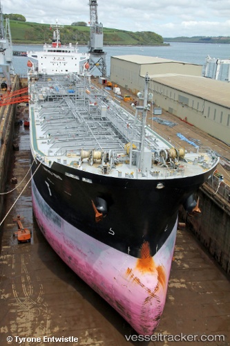
Vessel profile: NAVIGATOR is a Oil/Chemical Tanker with dimensions m x m.
This page combines live AIS, route history, probable destination signals, nearby traffic, and port activity for practical vessel monitoring.
The current position of vessel NAVIGATOR is 41.70536 lat / 12.17914 lng. Updated: 2026-05-19 01:49:17 UTCNearest reference points:
- Near Fiumicino
- Near Torvaianica
- Near Santa Marinella
Currently sailing under the flag of Marshall Islands ![]()
Details:
Live Vessel NAVIGATOR Analytics (details, animations, etc.)
Recent AIS points (UTC):
2026-05-18 22:55:17 UTC · 41.70426, 12.17625 · SOG 0 kn · COG 18°2026-05-19 00:04:20 UTC · 41.70446, 12.17649 · SOG 0 kn · COG 10°
2026-05-19 01:22:17 UTC · 41.70582, 12.17906 · SOG 0 kn · COG 275°
2026-05-19 01:49:17 UTC · 41.70536, 12.17914 · SOG 0 kn · COG 291°