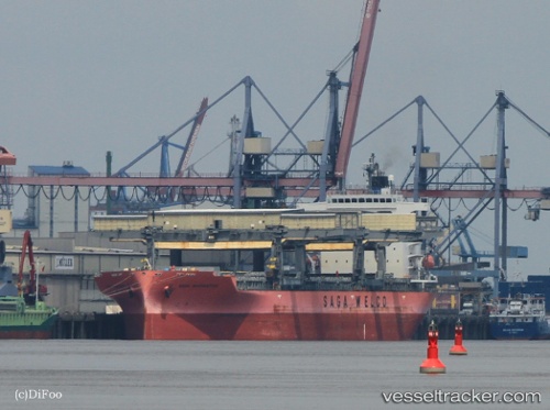
 SAGA NAVIGATOR
Current Status
Where is the vessel?
SAGA NAVIGATOR is currently in Near Kitimat, based on AIS data received about 15h ago.
Latest AIS update:
Current position: 53.99412° N, 128.69258° W (Near Kitimat)
Average speed (last 7 days): Loading…
Average speed (last 30 days): Loading…
Vessel profile: SAGA NAVIGATOR is a General Cargo with dimensions m x m.
This page combines live AIS, route history, probable destination signals, nearby traffic, and port activity for practical vessel monitoring.
The current position of vessel SAGA NAVIGATOR is 53.99412 lat / -128.69258 lng. Updated: 2026-05-20 11:57:55 UTCNearest reference points:
- Near Kitimat
- 11 nm S of Kitimat
- 39 nm S of Butedale
Currently sailing under the flag of Bahamas ![]()
Details:
Live Vessel SAGA NAVIGATOR Analytics (details, animations, etc.)
Recent AIS points (UTC):
2026-05-20 07:57:58 UTC · 53.99413, -128.69254 · SOG 0 kn · COG 354°2026-05-20 10:24:56 UTC · 53.99412, -128.69255 · SOG 0 kn · COG 354°
2026-05-20 10:55:01 UTC · 53.99410, -128.69255 · SOG 0 kn · COG 354°
2026-05-20 11:57:55 UTC · 53.99412, -128.69258 · SOG 0 kn · COG 354°