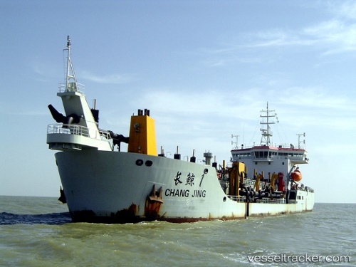
 Chang Jing 1
Current Status
Where is the vessel?
Chang Jing 1 is currently in Near Lusi, based on AIS data received about 14h ago.
Latest AIS update:
Current position: 32.07914° N, 121.66747° E (Near Lusi)
Average speed (last 7 days): Loading…
Average speed (last 30 days): Loading…
Vessel profile: Chang Jing 1 is a Hopper Dredger with dimensions 133m x 22m.
This page combines live AIS, route history, probable destination signals, nearby traffic, and port activity for practical vessel monitoring.
The current position of vessel Chang Jing 1 is 32.07914 lat / 121.66747 lng. Updated: 2026-07-02 19:40:57 UTCNearest reference points:
- Near Lusi
- 14 nm N of Lusi
- 12 nm N of Taicang
Currently sailing under the flag of China ![]()
Details:
Live Vessel Chang Jing 1 Analytics (details, animations, etc.)
Recent AIS points (UTC):
2026-07-02 16:10:11 UTC · 32.07819, 121.66590 · SOG 0.1 kn · COG -1°2026-07-02 17:57:09 UTC · 32.07997, 121.66606 · SOG 0 kn · COG 169°
2026-07-02 19:25:40 UTC · 32.07961, 121.66726 · SOG 0.1 kn · COG -1°
2026-07-02 19:40:57 UTC · 32.07914, 121.66747 · SOG 0 kn · COG 273°