 vesseltracker.com
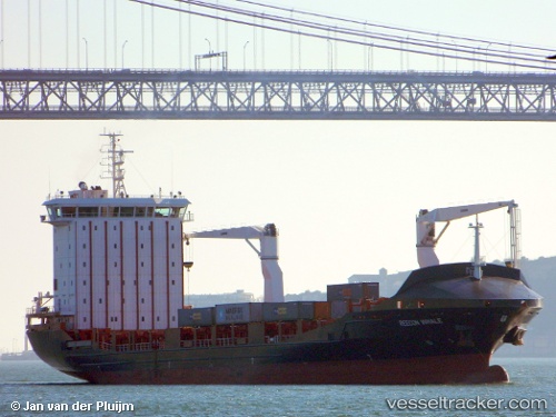
 Vera A
Current Status
Where is the vessel?
Vera A is currently in 18 nm E of Blackwater, based on AIS data received less than 1h ago.
Latest AIS update:
Current position: 52.43688° N, 5.83198° W (18 nm E of Blackwater)
Average speed (last 7 days): Loading…
Average speed (last 30 days): Loading…
Vessel profile: Vera A is a Container Ship with dimensions 145m x 22m.
This page combines live AIS, route history, probable destination signals, nearby traffic, and port activity for practical vessel monitoring.
The current position of vessel Vera A is 52.43688 lat / -5.83198 lng. Updated: 2026-05-15 13:49:57 UTCNearest reference points:
- Near ARKLOW
- Near WICKLOW
- Near WEXFORD
Currently sailing under the flag of Malta ![]()
Vera A built in 2011 year
Deadweight:
12513 tDetails:
Live Vessel Vera A Analytics (details, animations, etc.)
Recent AIS points (UTC):
2026-05-15 09:56:29 UTC · 51.79857, -5.81359 · SOG 10.4 kn · COG 13°2026-05-15 11:47:29 UTC · 52.10215, -5.79855 · SOG 9.6 kn · COG 2°
2026-05-15 13:05:40 UTC · 52.31137, -5.82345 · SOG 9.8 kn · COG 2°
2026-05-15 13:49:57 UTC · 52.43688, -5.83198 · SOG 10.4 kn · COG 2°