 vesseltracker.com
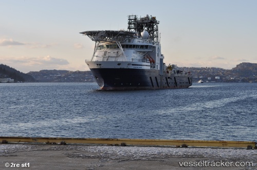
Island Wellserver
Current StatusWhere is the vessel?
Island Wellserver is currently in Near Sygna, based on AIS data received about 2h ago.
Latest AIS update:
Current position: 61.49500° N, 2.14667° E (Near Sygna)
Average speed (last 7 days): Loading…
Average speed (last 30 days): Loading…
Vessel profile: Island Wellserver is a Well Stimulation Vessel with dimensions 26m x 116m.
This page combines live AIS, route history, probable destination signals, nearby traffic, and port activity for practical vessel monitoring.
The current position of vessel Island Wellserver is 61.49500 lat / 2.14667 lng. Updated: 2026-05-15 00:54:33 UTCNearest reference points:
- 10 nm N of Leadon
Details:
Live Vessel Island Wellserver Analytics (details, animations, etc.)
Recent AIS points (UTC):
2026-05-14 21:48:30 UTC · 61.49500, 2.14667 · SOG 0 kn · COG -1°2026-05-14 21:48:30 UTC · 61.49500, 2.14667 · SOG 0 kn · COG -1°
2026-05-14 23:51:32 UTC · 61.49500, 2.14667 · SOG 0 kn · COG -1°
2026-05-15 00:54:33 UTC · 61.49500, 2.14667 · SOG 0 kn · COG -1°