 CMA CGM PEMBA
Current Status
Where is the vessel?
CMA CGM PEMBA is currently in 32 nm W of PUERTO BOLIVAR, based on AIS data received about 15h ago.
Latest AIS update:
Current position: 12.36833° N, 72.49667° W (32 nm W of PUERTO BOLIVAR)
Average speed (last 7 days): Loading…
Average speed (last 30 days): Loading…
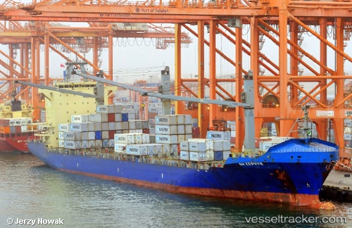
Vessel profile: CMA CGM PEMBA is a Container Ship with dimensions 30m x 212m.
This page combines live AIS, route history, probable destination signals, nearby traffic, and port activity for practical vessel monitoring.
The current position of vessel CMA CGM PEMBA is 12.36833 lat / -72.49667 lng. Updated: 2026-07-05 03:45:35 UTCNearest reference points:
- Near PUERTO BOLIVAR
- 18 nm N of Santa Marta
- Near Santa Marta
Currently sailing under the flag of Malta ![]()
CMA CGM PEMBA built in 2008 year
Deadweight:
34324 tDetails:
Live Vessel CMA CGM PEMBA Analytics (details, animations, etc.)
Recent AIS points (UTC):
2026-07-04 23:42:37 UTC · 12.07500, -73.26167 · SOG 11 kn · COG -1°2026-07-05 00:58:20 UTC · 12.16756, -73.02708 · SOG 12.1 kn · COG 70°
2026-07-05 02:19:24 UTC · 12.26256, -72.77088 · SOG 11.5 kn · COG 68°
2026-07-05 03:45:35 UTC · 12.36833, -72.49667 · SOG 12 kn · COG -1°