 vesseltracker.com
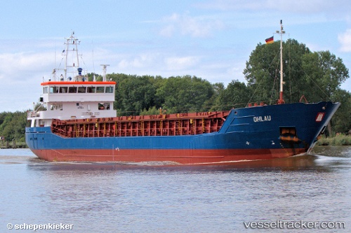
 RHEINTAL
Current Status
Where is the vessel?
RHEINTAL is currently in 31 nm SE of Fuengirola, based on AIS data received less than 1h ago.
Latest AIS update:
Current position: 36.13327° N, 4.19972° W (31 nm SE of Fuengirola)
Average speed (last 7 days): Loading…
Average speed (last 30 days): Loading…
Vessel profile: RHEINTAL is a General Cargo Ship with dimensions 88m x 13m.
This page combines live AIS, route history, probable destination signals, nearby traffic, and port activity for practical vessel monitoring.
The current position of vessel RHEINTAL is 36.13327 lat / -4.19972 lng. Updated: 2026-05-14 11:35:44 UTCNearest reference points:
- 31 nm SE of Fuengirola
- 24 nm S of El Morche
- 30 nm E of Ceuta
Currently sailing under the flag of Portugal (MAR) ![]()
RHEINTAL built in 2007 year
Deadweight:
3689 tDetails:
Live Vessel RHEINTAL Analytics (details, animations, etc.)
Recent AIS points (UTC):
2026-05-14 07:23:04 UTC · 36.04073, -5.05996 · SOG 11.6 kn · COG 77°2026-05-14 09:42:24 UTC · 36.08983, -4.56205 · SOG 9.8 kn · COG 80°
2026-05-14 10:39:14 UTC · 36.11557, -4.37908 · SOG 9.2 kn · COG 80°
2026-05-14 11:35:44 UTC · 36.13327, -4.19972 · SOG 9.2 kn · COG 82°