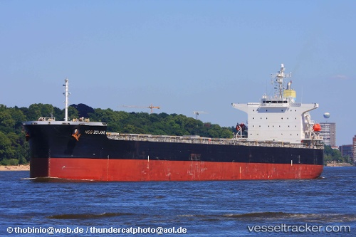
 CRETANSEA
Current Status
Where is the vessel?
CRETANSEA is currently in 14 nm E of Mundra Port SEZ, based on AIS data received about 15h ago.
Latest AIS update:
Current position: 22.80756° N, 69.97987° E (14 nm E of Mundra Port SEZ)
Average speed (last 7 days): Loading…
Average speed (last 30 days): Loading…
Vessel profile: CRETANSEA is a Bulk Carrier with dimensions m x m.
This page combines live AIS, route history, probable destination signals, nearby traffic, and port activity for practical vessel monitoring.
The current position of vessel CRETANSEA is 22.80756 lat / 69.97987 lng. Updated: 2026-05-20 03:24:06 UTCNearest reference points:
- 12 nm N of Rozi
- 15 nm N of Rozi
- Near Rozi
Currently sailing under the flag of Marshall Islands ![]()
Details:
Live Vessel CRETANSEA Analytics (details, animations, etc.)
Recent AIS points (UTC):
2026-05-19 23:34:25 UTC · 22.80833, 69.98167 · SOG 0 kn · COG -1°2026-05-20 01:08:54 UTC · 22.80746, 69.97997 · SOG 0.1 kn · COG -1°
2026-05-20 02:08:20 UTC · 22.80769, 69.97954 · SOG 0 kn · COG 32°
2026-05-20 03:24:06 UTC · 22.80756, 69.97987 · SOG 0 kn · COG -1°