 HAKKAISAN
Current Status
Where is the vessel?
HAKKAISAN is currently in Open sea, approx. 525 nm off the nearest listed port, based on AIS data received about 15h ago.
Latest AIS update:
Current position: 3.55112° N, 62.27116° E (Open sea, approx. 525 nm off the nearest listed port)
Average speed (last 7 days): Loading…
Average speed (last 30 days): Loading…
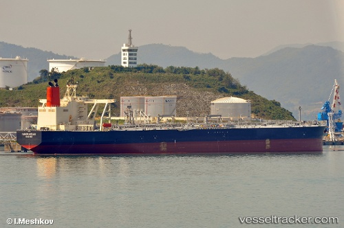
Vessel profile: HAKKAISAN is a Crude Oil Tanker with dimensions m x m.
This page combines live AIS, route history, probable destination signals, nearby traffic, and port activity for practical vessel monitoring.
The current position of vessel HAKKAISAN is 3.55112 lat / 62.27116 lng. Updated: 2026-05-19 23:34:33 UTCNearest reference points:
- Open sea, approx. 525 nm off the nearest listed port
- Open sea, approx. 523 nm off the nearest listed port
- Open sea, approx. 522 nm off the nearest listed port
Currently sailing under the flag of Panama ![]()
Details:
Live Vessel HAKKAISAN Analytics (details, animations, etc.)
Recent AIS points (UTC):
2026-05-19 19:52:00 UTC · 2.78167, 62.02500 · SOG 12 kn · COG -1°2026-05-19 21:42:40 UTC · 3.16514, 62.14894 · SOG 12.9 kn · COG 13°
2026-05-19 22:00:58 UTC · 3.22833, 62.16667 · SOG 12 kn · COG -1°
2026-05-19 23:34:33 UTC · 3.55112, 62.27116 · SOG 13.1 kn · COG 16°