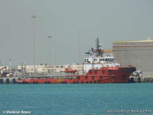
Halul 28
Current StatusWhere is the vessel?
Halul 28 is currently in Near RAS LAFFAN, based on AIS data received about 1d ago.
Latest AIS update:
Current position: 25.84563° N, 51.64181° E (Near RAS LAFFAN)
Average speed (last 7 days): Loading…
Average speed (last 30 days): Loading…
Vessel profile: Halul 28 is a Offshore Tug Supply Ship with dimensions 15m x 59m.
This page combines live AIS, route history, probable destination signals, nearby traffic, and port activity for practical vessel monitoring.
The current position of vessel Halul 28 is 25.84563 lat / 51.64181 lng. Updated: 2026-05-19 18:03:56 UTCNearest reference points:
- Near RAS LAFFAN
- Near KHALIFA BIN SALMAN
- Near Sitrah Anchorage
Details:
Live Vessel Halul 28 Analytics (details, animations, etc.)
Recent AIS points (UTC):
2026-05-19 18:03:56 UTC · 25.84563, 51.64181 · SOG 3.1 kn · COG 174°2026-05-19 18:03:56 UTC · 25.84563, 51.64181 · SOG 3.1 kn · COG 174°
2026-05-19 18:03:56 UTC · 25.84563, 51.64181 · SOG 3.1 kn · COG 174°
2026-05-19 18:03:56 UTC · 25.84563, 51.64181 · SOG 3.1 kn · COG 174°