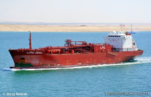
Clipper Hermod
Current StatusWhere is the vessel?
Clipper Hermod is currently in 100 nm NW of Swansea, based on AIS data received about 14h ago.
Latest AIS update:
Current position: 52.57500° N, 33.14667° W (100 nm NW of Swansea)
Average speed (last 7 days): Loading…
Average speed (last 30 days): Loading…
Vessel profile: Clipper Hermod is a Lpg Tanker with dimensions 21m x 155m.
This page combines live AIS, route history, probable destination signals, nearby traffic, and port activity for practical vessel monitoring.
The current position of vessel Clipper Hermod is 52.57500 lat / -33.14667 lng. Updated: 2026-05-20 18:15:31 UTCDetails:
Live Vessel Clipper Hermod Analytics (details, animations, etc.)
Recent AIS points (UTC):
2026-05-20 13:51:31 UTC · 53.39500, -31.89167 · SOG 15 kn · COG -1°2026-05-20 16:06:34 UTC · 52.98333, -32.55500 · SOG 15 kn · COG -1°
2026-05-20 16:33:21 UTC · 52.89813, -32.68048 · SOG 15.3 kn · COG 219°
2026-05-20 18:15:31 UTC · 52.57500, -33.14667 · SOG 15 kn · COG -1°