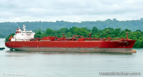
 ATLANTIC VICTORY
Current Status
Where is the vessel?
ATLANTIC VICTORY is currently in 19 nm NW of Zanzibar, based on AIS data received about 14h ago.
Latest AIS update:
Current position: 5.91667° S, 38.99667° E (19 nm NW of Zanzibar)
Average speed (last 7 days): Loading…
Average speed (last 30 days): Loading…
Vessel profile: ATLANTIC VICTORY is a Lpg Tanker with dimensions m x m.
This page combines live AIS, route history, probable destination signals, nearby traffic, and port activity for practical vessel monitoring.
The current position of vessel ATLANTIC VICTORY is -5.91667 lat / 38.99667 lng. Updated: 2026-05-21 03:48:21 UTCNearest reference points:
- Near Dar Es Salaam
- Near Mombasa
- 11 nm SE of Mombasa
Currently sailing under the flag of Panama ![]()
Details:
Live Vessel ATLANTIC VICTORY Analytics (details, animations, etc.)
Recent AIS points (UTC):
2026-05-21 00:15:20 UTC · -5.91667, 38.99667 · SOG 0 kn · COG -1°2026-05-21 01:00:20 UTC · -5.91667, 38.99667 · SOG 0 kn · COG -1°
2026-05-21 02:03:21 UTC · -5.91667, 38.99667 · SOG 0 kn · COG -1°
2026-05-21 03:48:21 UTC · -5.91667, 38.99667 · SOG 0 kn · COG -1°