 POLLUX
Current Status
Where is the vessel?
POLLUX is currently in 30 nm E of Vardo, based on AIS data received about 14h ago.
Latest AIS update:
Current position: 70.48833° N, 32.54833° E (30 nm E of Vardo)
Average speed (last 7 days): Loading…
Average speed (last 30 days): Loading…
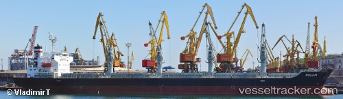
Vessel profile: POLLUX is a Bulk Carrier with dimensions 29m x 175m.
This page combines live AIS, route history, probable destination signals, nearby traffic, and port activity for practical vessel monitoring.
The current position of vessel POLLUX is 70.48833 lat / 32.54833 lng. Updated: 2026-05-20 13:01:58 UTCNearest reference points:
- Near Ozerko
- 12 nm NE of Ura-Guba
- Near Ura-Guba
Currently sailing under the flag of Liberia ![]()
POLLUX built in 2007 year
Deadweight:
32017 tDetails:
Live Vessel POLLUX Analytics (details, animations, etc.)
Recent AIS points (UTC):
2026-05-20 09:02:50 UTC · 69.77060, 33.59760 · SOG 11.9 kn · COG 358°2026-05-20 09:02:50 UTC · 69.77060, 33.59760 · SOG 11.9 kn · COG 358°
2026-05-20 11:38:11 UTC · 70.25141, 33.01253 · SOG 12.2 kn · COG 328°
2026-05-20 13:01:58 UTC · 70.48833, 32.54833 · SOG 12 kn · COG -1°