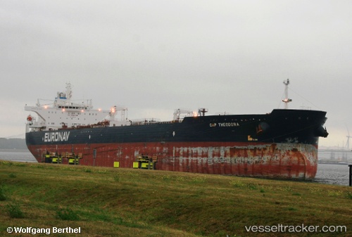
Cap Theodora
Current StatusWhere is the vessel?
Cap Theodora is currently in 44 nm NW of Vedado, based on AIS data received about 15h ago.
Latest AIS update:
Current position: 23.78883° N, 83.76002° W (44 nm NW of Vedado)
Average speed (last 7 days): Loading…
Average speed (last 30 days): Loading…
Vessel profile: Cap Theodora is a Crude Oil Tanker with dimensions 46m x 274m.
This page combines live AIS, route history, probable destination signals, nearby traffic, and port activity for practical vessel monitoring.
The current position of vessel Cap Theodora is 23.78883 lat / -83.76002 lng. Updated: 2026-05-20 07:19:02 UTCNearest reference points:
- 14 nm W of Florida Straits
- 40 nm S of Florida Straits
- Near Mariel
Details:
Live Vessel Cap Theodora Analytics (details, animations, etc.)
Recent AIS points (UTC):
2026-05-20 04:37:16 UTC · 23.75708, -83.25127 · SOG 10.8 kn · COG -1°2026-05-20 05:48:29 UTC · 23.77993, -83.47930 · SOG 10.3 kn · COG -1°
2026-05-20 07:14:01 UTC · 23.78817, -83.74490 · SOG 10.1 kn · COG -1°
2026-05-20 07:19:02 UTC · 23.78883, -83.76002 · SOG 10.3 kn · COG -1°