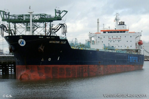
 MINERVA JULIE
Current Status
Where is the vessel?
MINERVA JULIE is currently in 26 nm NE of Jonesville, based on AIS data received about 15h ago.
Latest AIS update:
Current position: 39.98833° N, 53.04196° W (26 nm NE of Jonesville)
Average speed (last 7 days): Loading…
Average speed (last 30 days): Loading…
Vessel profile: MINERVA JULIE is a Oil/Chemical Tanker with dimensions m x m.
This page combines live AIS, route history, probable destination signals, nearby traffic, and port activity for practical vessel monitoring.
The current position of vessel MINERVA JULIE is 39.98833 lat / -53.04196 lng. Updated: 2026-05-20 10:31:52 UTCNearest reference points:
- 44 nm SE of Jonesville
- 63 nm SE of Azuara
- 76 nm SW of Seica
Currently sailing under the flag of Liberia ![]()
Details:
Live Vessel MINERVA JULIE Analytics (details, animations, etc.)
Recent AIS points (UTC):
2026-05-20 09:53:10 UTC · 39.99056, -53.19092 · SOG 10.3 kn · COG 89°2026-05-20 09:53:10 UTC · 39.99056, -53.19092 · SOG 10.3 kn · COG 89°
2026-05-20 10:31:52 UTC · 39.98833, -53.04196 · SOG 10.6 kn · COG 99°
2026-05-20 10:31:52 UTC · 39.98833, -53.04196 · SOG 10.6 kn · COG 99°