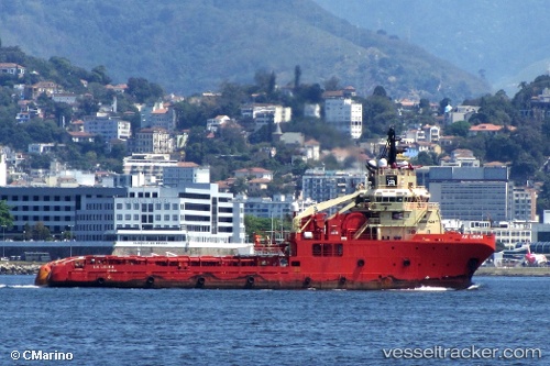
 A. H. LIGURIA
Current Status
Where is the vessel?
A. H. LIGURIA is currently in 54 nm N of Cidade de Angra dos Reis FPSO, based on AIS data received about 14h ago.
Latest AIS update:
Current position: 24.67667° S, 42.50500° W (54 nm N of Cidade de Angra dos Reis FPSO)
Average speed (last 7 days): Loading…
Average speed (last 30 days): Loading…
Vessel profile: A. H. LIGURIA is a Offshore Tug/Supply Ship with dimensions 76m x 76m.
This page combines live AIS, route history, probable destination signals, nearby traffic, and port activity for practical vessel monitoring.
The current position of vessel A. H. LIGURIA is -24.67667 lat / -42.50500 lng. Updated: 2026-05-20 11:53:16 UTCNearest reference points:
- 69 nm NE of Cidade de Angra dos Reis FPSO
- 34 nm S of Cidade de Angra dos Reis FPSO
- 49 nm S of SEPETIBA
Currently sailing under the flag of Brazil ![]()
A. H. LIGURIA built in 2008 year
Deadweight:
2945 tDetails:
Live Vessel A. H. LIGURIA Analytics (details, animations, etc.)
Recent AIS points (UTC):
2026-05-20 07:47:17 UTC · -24.67667, -42.50167 · SOG 0 kn · COG -1°2026-05-20 09:20:15 UTC · -24.67667, -42.50167 · SOG 0 kn · COG -1°
2026-05-20 11:05:17 UTC · -24.67500, -42.50500 · SOG 0 kn · COG -1°
2026-05-20 11:53:16 UTC · -24.67667, -42.50500 · SOG 0 kn · COG -1°