 Gulf Baynunah
Current Status
Where is the vessel?
Gulf Baynunah is currently in 67 nm E of Santa Venera, based on AIS data received about 14h ago.
Latest AIS update:
Current position: 35.78805° N, 144.76390° E (67 nm E of Santa Venera)
Average speed (last 7 days): Loading…
Average speed (last 30 days): Loading…
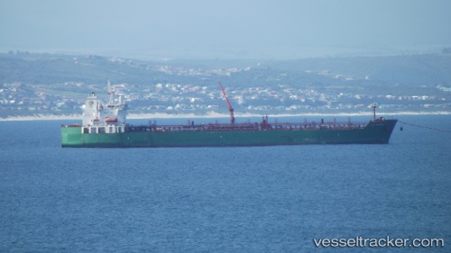
Vessel profile: Gulf Baynunah is a Chemical Oil Products Tanker with dimensions 183m x 32m.
This page combines live AIS, route history, probable destination signals, nearby traffic, and port activity for practical vessel monitoring.
The current position of vessel Gulf Baynunah is 35.78805 lat / 144.76390 lng. Updated: 2026-05-22 07:10:01 UTCCurrently sailing under the flag of Bahamas ![]()
Gulf Baynunah built in 2008 year
Deadweight:
46522 tDetails:
Live Vessel Gulf Baynunah Analytics (details, animations, etc.)
Recent AIS points (UTC):
2026-05-22 04:04:01 UTC · 35.55340, 144.20343 · SOG 10.8 kn · COG 61°2026-05-22 05:24:19 UTC · 35.67308, 144.45068 · SOG 9.8 kn · COG 67°
2026-05-22 07:10:01 UTC · 35.78805, 144.76390 · SOG 9.2 kn · COG 57°
2026-05-22 07:10:01 UTC · 35.78805, 144.76390 · SOG 9.2 kn · COG 57°