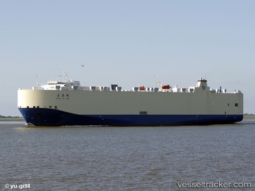
 Chang Tai Hong
Current Status
Where is the vessel?
Chang Tai Hong is currently in 33 nm N of Colomadu, based on AIS data received about 15h ago.
Latest AIS update:
Current position: 8.06833° N, 110.85500° E (33 nm N of Colomadu)
Average speed (last 7 days): Loading…
Average speed (last 30 days): Loading…
Vessel profile: Chang Tai Hong is a Vehicles Carrier with dimensions 176m x 31m.
This page combines live AIS, route history, probable destination signals, nearby traffic, and port activity for practical vessel monitoring.
The current position of vessel Chang Tai Hong is 8.06833 lat / 110.85500 lng. Updated: 2026-05-20 10:11:27 UTCNearest reference points:
- 41 nm NW of Brebes
- 156 nm SE of Phan Rang-Tháp Chàm
- 142 nm N of Pulau Lang Lang
Currently sailing under the flag of China ![]()
Chang Tai Hong built in 2009 year
Deadweight:
12282 tDetails:
Live Vessel Chang Tai Hong Analytics (details, animations, etc.)
Recent AIS points (UTC):
2026-05-20 07:29:29 UTC · 8.66333, 111.17167 · SOG 14 kn · COG -1°2026-05-20 07:50:27 UTC · 8.58667, 111.13333 · SOG 14 kn · COG -1°
2026-05-20 09:35:33 UTC · 8.19167, 110.93833 · SOG 15 kn · COG -1°
2026-05-20 10:11:27 UTC · 8.06833, 110.85500 · SOG 14 kn · COG -1°