 vesseltracker.com
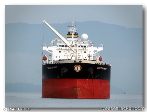
World Harmony
Current StatusWhere is the vessel?
World Harmony is currently in 29 nm NW of Manta, based on AIS data received less than 1h ago.
Latest AIS update:
Current position: 0.68602° S, 81.14083° W (29 nm NW of Manta)
Average speed (last 7 days): Loading…
Average speed (last 30 days): Loading…
Vessel profile: World Harmony is a Crude Oil Tanker with dimensions 32m x 228m.
This page combines live AIS, route history, probable destination signals, nearby traffic, and port activity for practical vessel monitoring.
The current position of vessel World Harmony is -0.68602 lat / -81.14083 lng. Updated: 2026-05-14 23:33:15 UTCNearest reference points:
- 22 nm W of Bahía de Caráquez
- Near MANTA
- Near La Libertad
Details:
Live Vessel World Harmony Analytics (details, animations, etc.)
Recent AIS points (UTC):
2026-05-14 19:44:17 UTC · -1.53341, -81.28011 · SOG 13.3 kn · COG 6°2026-05-14 21:50:11 UTC · -1.06714, -81.21980 · SOG 13.4 kn · COG 4°
2026-05-14 23:09:46 UTC · -0.76817, -81.18355 · SOG 14 kn · COG 24°
2026-05-14 23:33:15 UTC · -0.68602, -81.14083 · SOG 13.9 kn · COG 24°