 vesseltracker.com
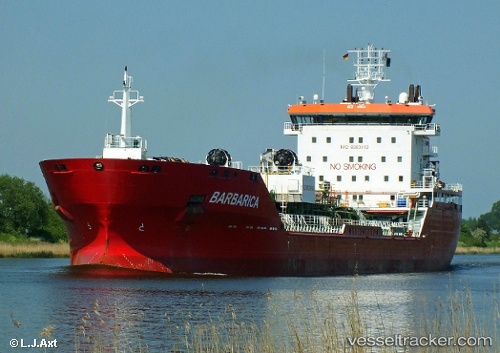
 Barbarica
Current Status
Where is the vessel?
Barbarica is currently in Near Gela, based on AIS data received less than 1h ago.
Latest AIS update:
Current position: 37.02167° N, 14.22667° E (Near Gela)
Average speed (last 7 days): Loading…
Average speed (last 30 days): Loading…
Vessel profile: Barbarica is a Chemical Oil Products Tanker with dimensions 148m x 23m.
This page combines live AIS, route history, probable destination signals, nearby traffic, and port activity for practical vessel monitoring.
The current position of vessel Barbarica is 37.02167 lat / 14.22667 lng. Updated: 2026-05-16 10:04:39 UTCNearest reference points:
- Near Gela
- Near Scoglitti
- Near Licata
Currently sailing under the flag of Malta ![]()
Barbarica built in 2007 year
Deadweight:
18818 tDetails:
Live Vessel Barbarica Analytics (details, animations, etc.)
Recent AIS points (UTC):
2026-05-16 07:29:06 UTC · 37.02422, 14.22807 · SOG 0 kn · COG 248°2026-05-16 07:43:50 UTC · 37.02414, 14.22809 · SOG 0 kn · COG 258°
2026-05-16 09:34:50 UTC · 37.02379, 14.22833 · SOG 0.1 kn · COG 263°
2026-05-16 10:04:39 UTC · 37.02167, 14.22667 · SOG 0 kn · COG -1°