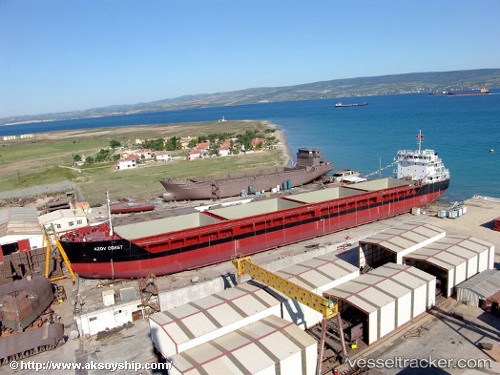
 AZOV COAST
Current Status
Where is the vessel?
AZOV COAST is currently in 63 nm S of Kastellorizou (ex Megísti), based on AIS data received about 14h ago.
Latest AIS update:
Current position: 35.14616° N, 29.97556° E (63 nm S of Kastellorizou (ex Megísti))
Average speed (last 7 days): Loading…
Average speed (last 30 days): Loading…
Vessel profile: AZOV COAST is a General Cargo with dimensions m x m.
This page combines live AIS, route history, probable destination signals, nearby traffic, and port activity for practical vessel monitoring.
The current position of vessel AZOV COAST is 35.14616 lat / 29.97556 lng. Updated: 2026-05-20 01:10:05 UTCNearest reference points:
- 108 nm S of Kastellorizou (ex Megísti)
- Near Finike
- Near KAS
Currently sailing under the flag of Saint Vincent and the Grenadines ![]()
Details:
Live Vessel AZOV COAST Analytics (details, animations, etc.)
Recent AIS points (UTC):
2026-05-20 01:10:05 UTC · 35.14616, 29.97556 · SOG 8.3 kn · COG 310°2026-05-20 01:10:05 UTC · 35.14616, 29.97556 · SOG 8.3 kn · COG 310°
2026-05-20 01:10:05 UTC · 35.14616, 29.97556 · SOG 8.3 kn · COG 310°
2026-05-20 01:10:05 UTC · 35.14616, 29.97556 · SOG 8.3 kn · COG 310°