 vesseltracker.com
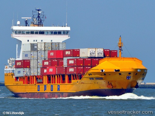
 Ef Ava
Current Status
Where is the vessel?
Ef Ava is currently in 140 nm SE of Garelochhead, based on AIS data received about 2h ago.
Latest AIS update:
Current position: 54.83500° N, 43.02167° W (140 nm SE of Garelochhead)
Average speed (last 7 days): Loading…
Average speed (last 30 days): Loading…
Vessel profile: Ef Ava is a Container Ship with dimensions 130m x 21m.
This page combines live AIS, route history, probable destination signals, nearby traffic, and port activity for practical vessel monitoring.
The current position of vessel Ef Ava is 54.83500 lat / -43.02167 lng. Updated: 2026-05-14 10:11:11 UTCCurrently sailing under the flag of Portugal ![]()
Ef Ava built in 2008 year
Deadweight:
8168 tDetails:
Live Vessel Ef Ava Analytics (details, animations, etc.)
Recent AIS points (UTC):
2026-05-14 07:05:09 UTC · 54.34167, -43.80667 · SOG 13 kn · COG -1°2026-05-14 07:42:15 UTC · 54.44072, -43.64684 · SOG 12.8 kn · COG 41°
2026-05-14 10:11:11 UTC · 54.83500, -43.02167 · SOG 13 kn · COG -1°
2026-05-14 10:11:11 UTC · 54.83500, -43.02167 · SOG 13 kn · COG -1°