 vesseltracker.com
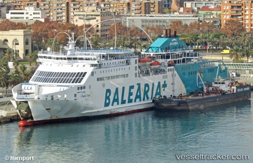
 Martin I Soler
Current Status
Where is the vessel?
Martin I Soler is currently in Near IBIZA, based on AIS data received less than 1h ago.
Latest AIS update:
Current position: 38.90793° N, 1.45003° E (Near IBIZA)
Average speed (last 7 days): Loading…
Average speed (last 30 days): Loading…
Vessel profile: Martin I Soler is a Passenger Ro Ro Cargo Ship with dimensions 165m x 25m.
This page combines live AIS, route history, probable destination signals, nearby traffic, and port activity for practical vessel monitoring.
The current position of vessel Martin I Soler is 38.90793 lat / 1.45003 lng. Updated: 2026-05-16 05:30:54 UTCNearest reference points:
- Near IBIZA
- Near SANTA EULARIA
- Near SANT ANTONI
Currently sailing under the flag of Spain ![]()
Martin I Soler built in 2008 year
Deadweight:
9737 tDetails:
Live Vessel Martin I Soler Analytics (details, animations, etc.)
Recent AIS points (UTC):
2026-05-16 01:49:40 UTC · 38.88514, 1.44622 · SOG 16.5 kn · COG 1°2026-05-16 03:22:45 UTC · 38.90793, 1.45010 · SOG 0 kn · COG 260°
2026-05-16 04:02:00 UTC · 38.90796, 1.45008 · SOG 0 kn · COG 259°
2026-05-16 05:30:54 UTC · 38.90793, 1.45003 · SOG 0 kn · COG 259°